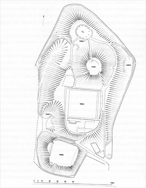
The hachured plan of Bailey Hill’s [SJ 235644] double-motted fortification ( below ) was initially based upon a detailed contour map. As part of a recent consultancy assessment; observations and an inspection of the site were undertaken by Bob Sylvester, Deputy Director of the Clwyd-Powys Archaeological Trust His examination updates the previous O.S. plan of 1959. It first appeared in Archaeology in Wales, 51(2012), 201-02.
Copyright of articles
published in Ystrad Alun lies with the Mold Civic Society and individual contributors.
Contents and opinions expressed therein
remains the responsibility of individual authors.